Screenshots


iPad screenshots

Icon palette
About this app
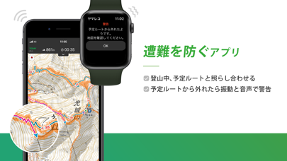
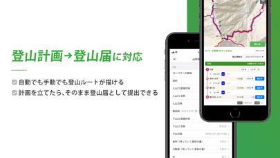
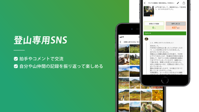
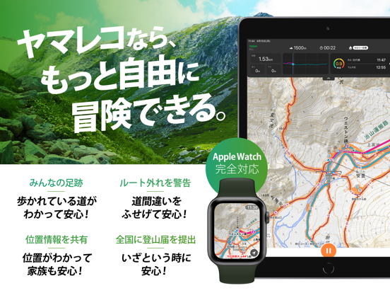
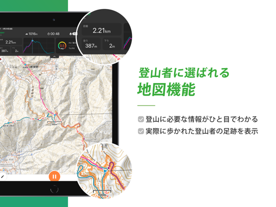
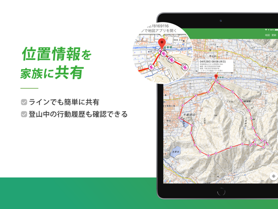
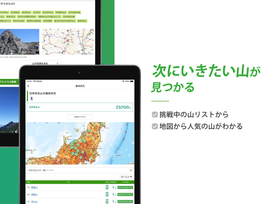
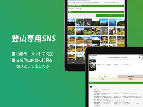
ヤマレコは、登山・アウトドア用GPSとして使える登山地図アプリケーションです。 あらかじめ予定している登山の地図やルート、地名などのデータをダウンロードしておけば、携帯電話の電波が届かない山の中でもGPSで現在地を確認できます。 登山の計画を作ったり、自分の記録を残してシェアしたり。あなたの登山がより安全に、楽しくなるサービスが満載です! 【特徴】 1)オフラインで登山地図が使える 登山に使える国土地理院の地図画像を、スマートフォンに保存して利用できます。 山に行く前に地図を保存しておくことで、ネットに繋がっていない山の中でもGPS衛星からの電波を使って現在地を特定し、地図を表示できます。 さらにヤマレコの「みんなの足跡」も重ねて表示されるので、実際にみんながどの場所を歩いているのか(登山道がどこにあるか)が一目でわかります。 もちろんヤマレコに登録された地名データも入っているので、従来の登山地図に載っていないマイナーな山や峠なども確認できます。 2)ルートと地図をセットでダウンロードできる …
App details
What you can learn from ヤマレコ 山登りがもっと楽しくなる登山アプリ
Every shipping app on the App Store has gone through the same decisions you're working through right now: which screenshot goes first, what caption sits over it, which device frame to show, what color the background should be. The 18 screenshots above are ヤマレコ 山登りがもっと楽しくなる登山アプリ's answers to those questions — they're public, they're real, and they made it through Apple's review.
Notice the first screenshot in particular. It's the one users see in search results and on the product page, and it's where most apps spend their best caption and tightest design. Look at the proportion of background to phone, where the text sits, what one thing the image is trying to communicate.
Want to see how other Sports apps approach the same problem? Browse more Sports apps in the showcase.
Take what works into your own screenshots
Open LaunchShots and design your App Store & Google Play screenshots — pick a device frame, drop captions, ship in minutes. Free, in your browser.
Open the screenshot editor →