Screenshots

Icon palette
About this app
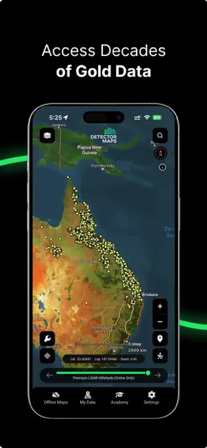
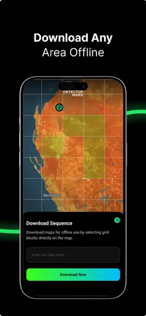
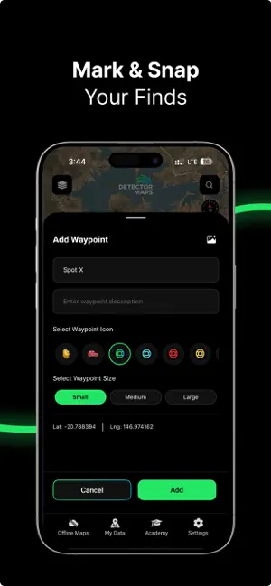
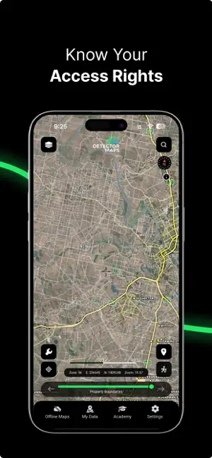
Detector Maps is your ultimate field tool for gold prospecting in Australia, the United States, and New Zealand. Built by geologists for real prospectors, it combines advanced geological datasets with intuitive GPS tools so you can explore smarter, stay on the gold, and avoid wasting time on low-potential ground, even offline. Whether you are swinging a detector, panning a creek, or hiking into remote country, Detector Maps puts rich geological intelligence in your pocket. WHAT MAKES DETECTOR MAPS DIFFERENT Advanced geological and gold-focused data. Built and curated specifically for prospectors. Optimised for mobile and offline field use. Included layers (where available): Surface geochemistry and filtering. Historic gold mines and workings. Current and expired mining leases / claims (updated every weekday). Optional LiDAR hillshade add-on for ultra-detailed terrain reading. BREA…
App details
What you can learn from Detector Maps
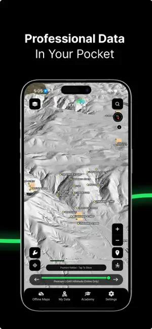
Every shipping app on the App Store has gone through the same decisions you're working through right now: which screenshot goes first, what caption sits over it, which device frame to show, what color the background should be. The 6 screenshots above are Detector Maps's answers to those questions — they're public, they're real, and they made it through Apple's review.
Notice the first screenshot in particular. It's the one users see in search results and on the product page, and it's where most apps spend their best caption and tightest design. Look at the proportion of background to phone, where the text sits, what one thing the image is trying to communicate.
Want to see how other Navigation apps approach the same problem? Browse more Navigation apps in the showcase.
Take what works into your own screenshots
Open LaunchShots and design your App Store & Google Play screenshots — pick a device frame, drop captions, ship in minutes. Free, in your browser.
Open the screenshot editor →