Screenshots

iPad screenshots
Icon palette
About this app
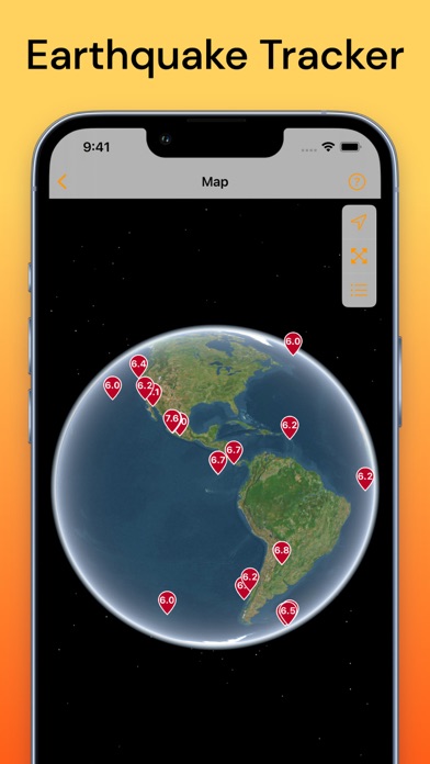
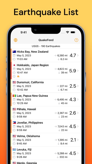
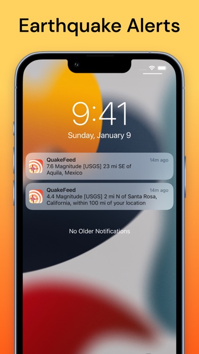
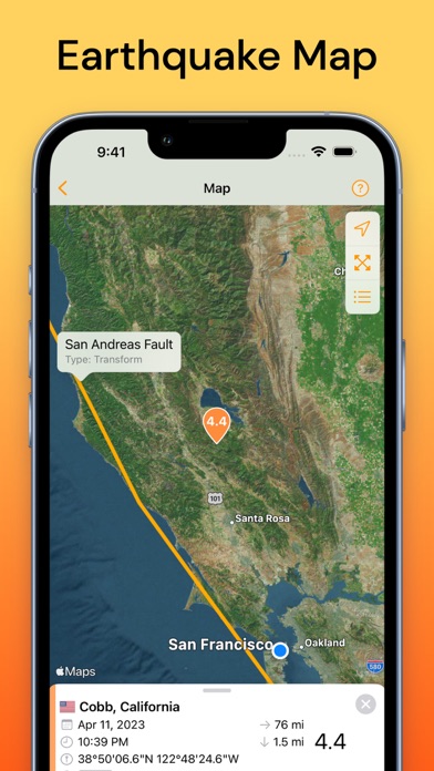
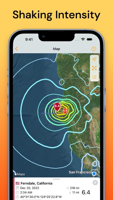
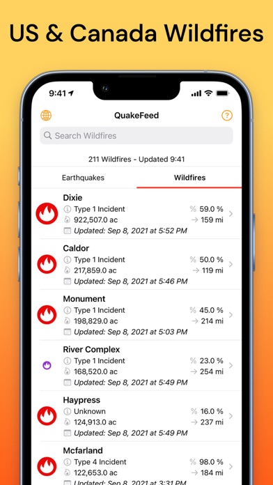
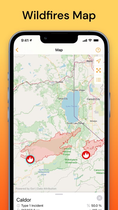
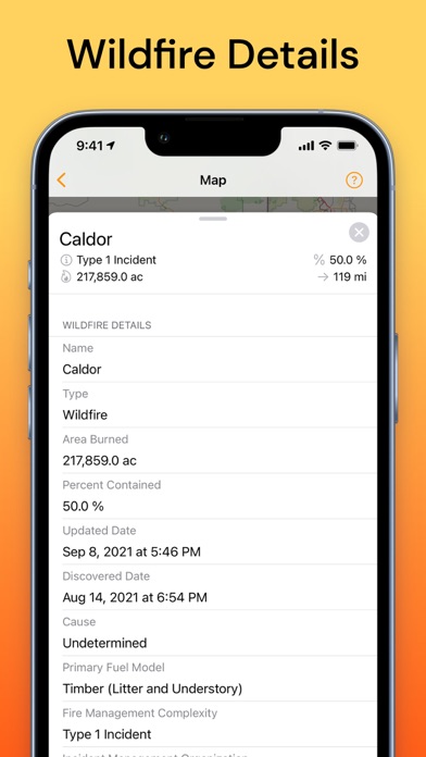
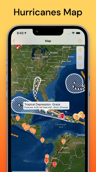
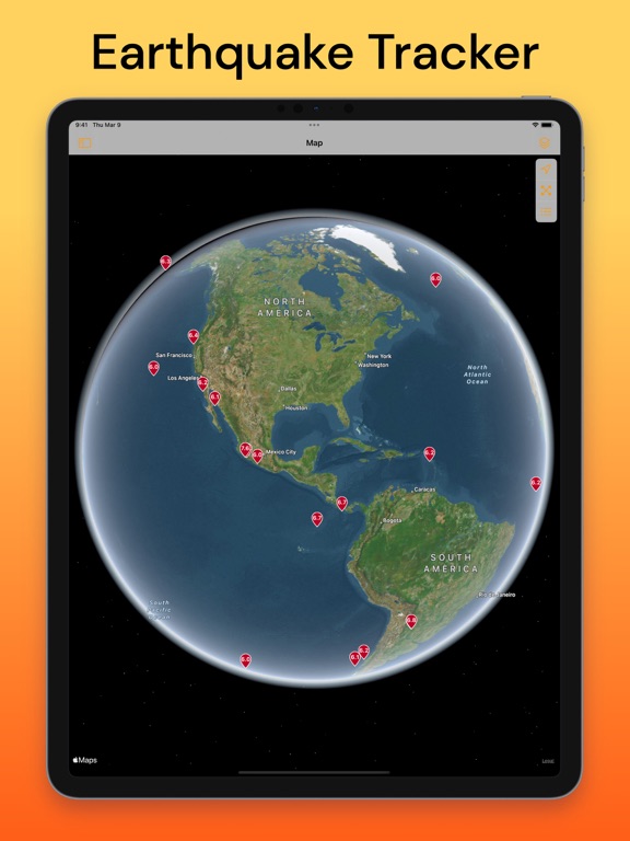
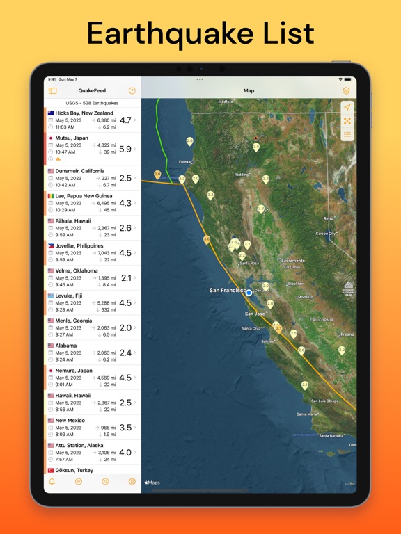
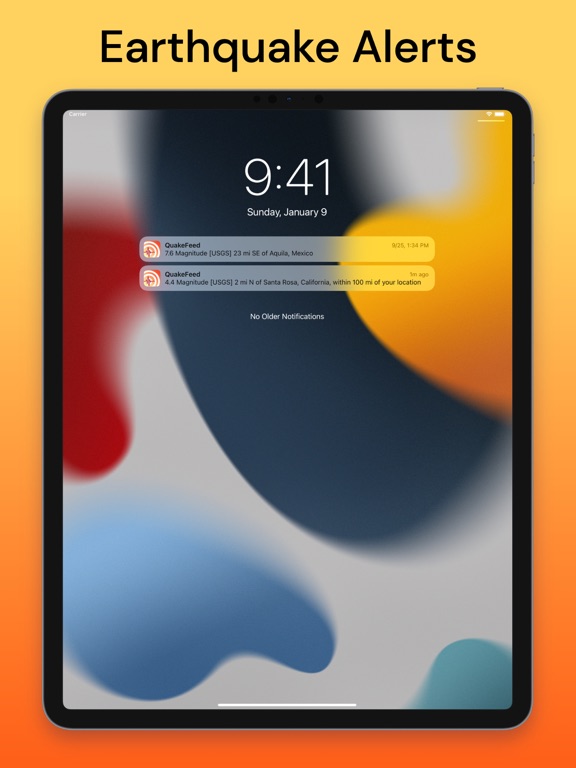
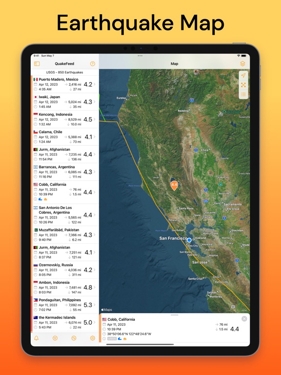
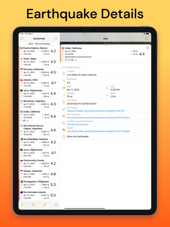
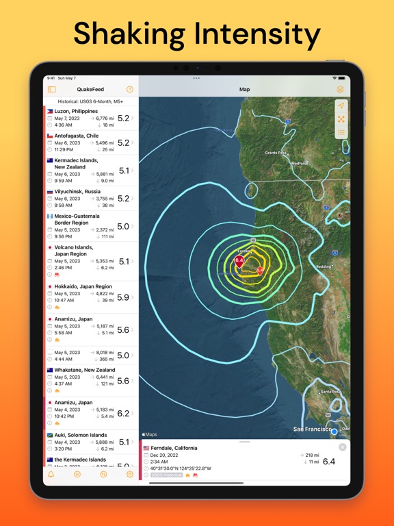
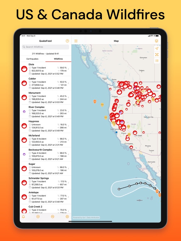
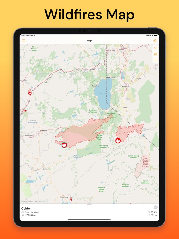
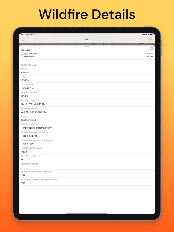
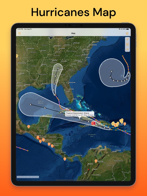
Worldwide earthquake tracker, map, and alerts. The most free features of any earthquake app. FREE VERSION INCLUDES: - Nearby earthquake alerts - Customisable regional alerts - 3D globe map - Satellite imagery and streets map - Multiple data sources (EMSC, USGS, NRC) - Search, sort, and filter earthquakes - Fault lines map layer - Links to USGS earthquake event page - Links to PAGER and aftershock forecast - Links to tsunami.gov PREMIUM SUBSCRIPTION INCLUDES: - Removes ads - MMI Contours (shaking intensity) - Historical earthquake data to 1900 - Eight premium basemaps - Erupting volcanoes - Hurricanes - USA & Canada Wildfires - North America smoke forecast layer WE RESPECT YOUR PRIVACY: - No ad tracking - No data sharing - Your precise location never leaves your device If you choose to purchase a QuakeFeed Premium Subscription, payment will be charged to your iTunes account at con…
App details
What you can learn from QuakeFeed Earthquake Alerts
Every shipping app on the App Store has gone through the same decisions you're working through right now: which screenshot goes first, what caption sits over it, which device frame to show, what color the background should be. The 20 screenshots above are QuakeFeed Earthquake Alerts's answers to those questions — they're public, they're real, and they made it through Apple's review.
Notice the first screenshot in particular. It's the one users see in search results and on the product page, and it's where most apps spend their best caption and tightest design. Look at the proportion of background to phone, where the text sits, what one thing the image is trying to communicate.
Want to see how other Weather apps approach the same problem? Browse more Weather apps in the showcase.
Take what works into your own screenshots
Open LaunchShots and design your App Store & Google Play screenshots — pick a device frame, drop captions, ship in minutes. Free, in your browser.
Open the screenshot editor →