Screenshots
iPad screenshots

Icon palette
About this app
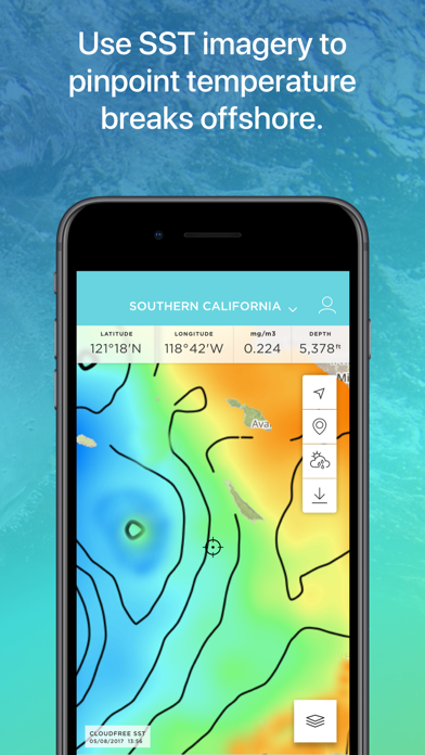
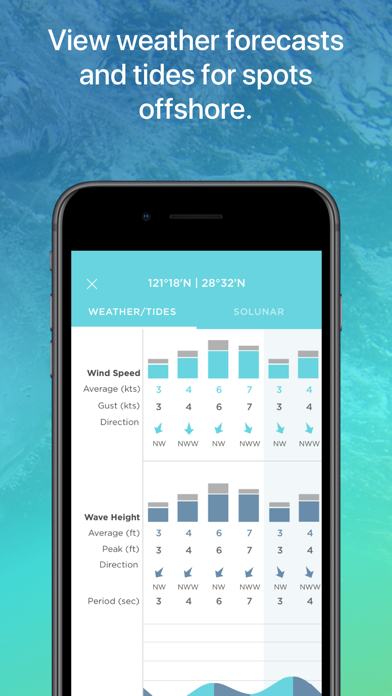
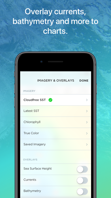
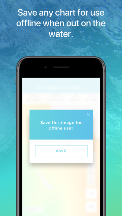
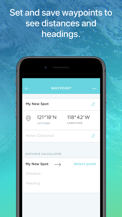
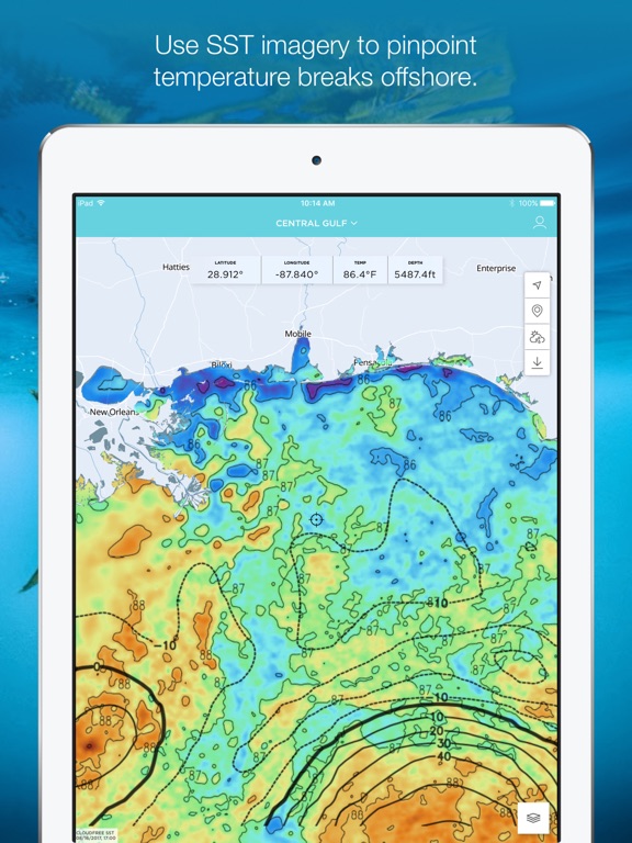
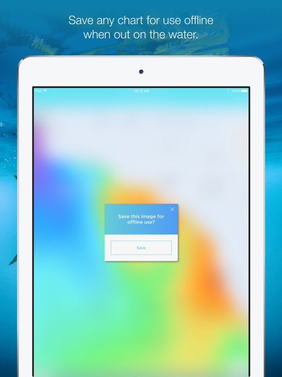
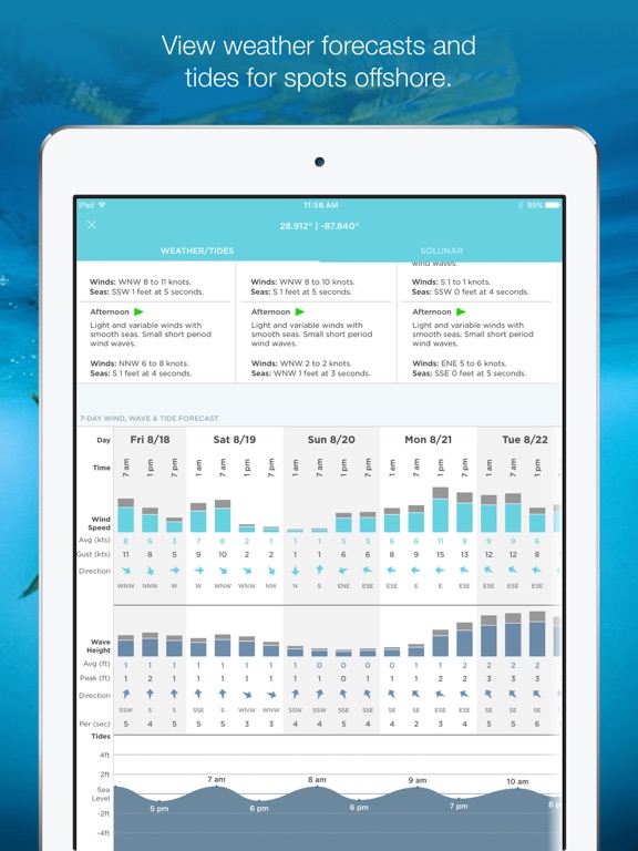
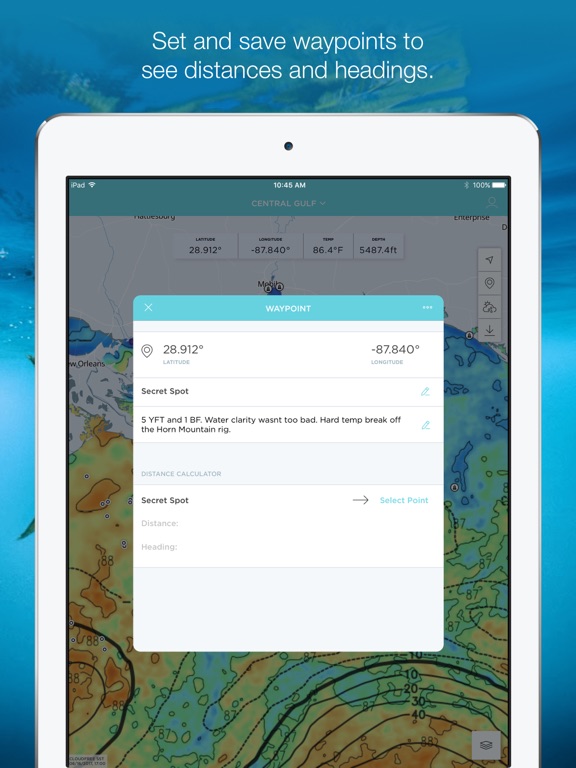
FishTrack provides saltwater anglers with everything they need to find fish. The FishTrack app offers Cloud-free Sea Surface Temperature (SST) charts, high-definition global satellite imagery, including water temperature charts, water color, currents, tides, moon phase and marine weather forecasts – all in one layered tool. Users can mark ‘hot spots’ and record GPS locations of temperature breaks and color barriers. Save imagery and overlay data for offline use to identify bite zones while navigating offshore. With FishTrack you can: -View the Latest SST and Chlorophyll imagery -Mark, name and save data of potential hot spots -Save fishing chart imagery for offline use -Plot waypoints and calculate distances -Overlay bathymetry, ocean currents and sea surface height -View marine weather forecasts -View your current location while offline Don't fish blind. Save time and fuel with the …
App details
What you can learn from FishTrack - Charts & Forecasts
Every shipping app on the App Store has gone through the same decisions you're working through right now: which screenshot goes first, what caption sits over it, which device frame to show, what color the background should be. The 10 screenshots above are FishTrack - Charts & Forecasts's answers to those questions — they're public, they're real, and they made it through Apple's review.
Notice the first screenshot in particular. It's the one users see in search results and on the product page, and it's where most apps spend their best caption and tightest design. Look at the proportion of background to phone, where the text sits, what one thing the image is trying to communicate.
Want to see how other Weather apps approach the same problem? Browse more Weather apps in the showcase.
Take what works into your own screenshots
Open LaunchShots and design your App Store & Google Play screenshots — pick a device frame, drop captions, ship in minutes. Free, in your browser.
Open the screenshot editor →