Screenshots
Icon palette
About this app
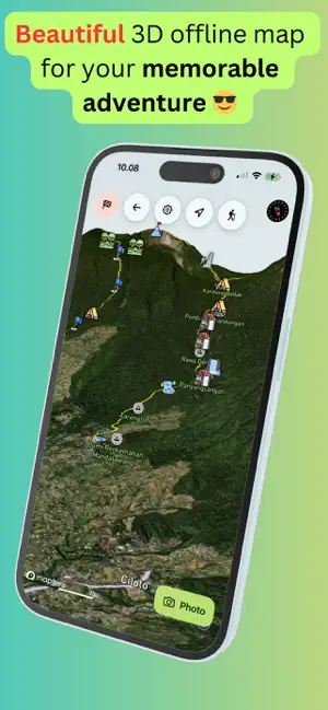
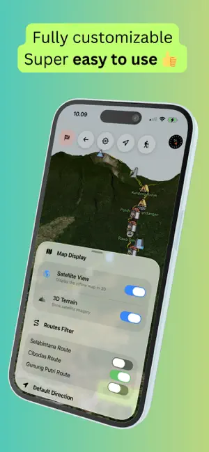
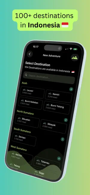
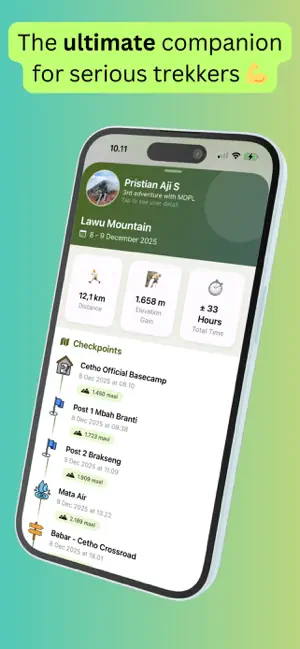
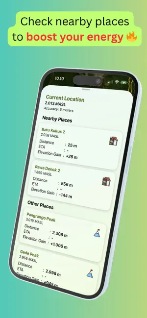
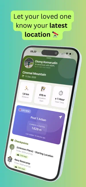
MDPL is an offline digital map app designed for hikers who want to climb mountains more safely, calmly, and enjoyably. It works without an internet connection, using your phone’s GPS sensor to detect your location in real time. See your exact position anytime and make sure you’re still on the trail you planned. Check your current location to estimate how long it will take to reach the next checkpoint. Use MDPL during your hike and get answers to common questions like: • “Are we still on the right path? What if we’re lost?” • “How much longer until we reach the next point? It feels endless!” • “What’s our elevation right now?” Other available features: • Add hiking information directly onto your photos • Checkpoints anywhere as route markers • Share your hiking stories with others • The best hiking gear for your next trip • much more coming soon — stay tuned! Use MDPL and support our…
App details
What you can learn from MDPL Adventure
Every shipping app on the App Store has gone through the same decisions you're working through right now: which screenshot goes first, what caption sits over it, which device frame to show, what color the background should be. The 6 screenshots above are MDPL Adventure's answers to those questions — they're public, they're real, and they made it through Apple's review.
Notice the first screenshot in particular. It's the one users see in search results and on the product page, and it's where most apps spend their best caption and tightest design. Look at the proportion of background to phone, where the text sits, what one thing the image is trying to communicate.
Want to see how other Navigation apps approach the same problem? Browse more Navigation apps in the showcase.
Take what works into your own screenshots
Open LaunchShots and design your App Store & Google Play screenshots — pick a device frame, drop captions, ship in minutes. Free, in your browser.
Open the screenshot editor →