Screenshot style breakdown
Sampled from 4 of GPS Geotag Photos & Camera Map's App Store screenshots — background, accent and theme, measured by LaunchShots (not something Apple publishes).
#9CDCFC bg
#89C1DD
#4C6C7C accent
#111111 text
Screenshots



Icon palette
About this app
Capture, Tag, Remember. All in One Place. Geotag Photos & Camera Map is your ultimate companion for capturing memories with precise location context. More than just a camera, it's a powerful tool that automatically tags every photo and video with GPS coordinates, weather data, and creates a personal visual map of your adventures. Key Features: All-in-One Media Hub: Seamlessly switch between high-quality Photo Camera and Video Recorder right within the app. No need to jump between different applications. Automatic & Rich Geotagging: Every shot is automatically embedded with precise GPS location (latitude/longitude), address, and even real-time weather conditions (temperature, conditions) at that moment. Never forget "where" or "when" again. Your Personal Camera Map: Visualize your life's journey on an interactive map! See all your geotagged photos and videos displayed as pins. Tap a…
App details
What you can learn from GPS Geotag Photos & Camera Map
Every shipping app on the App Store has gone through the same decisions you're working through right now: which screenshot goes first, what caption sits over it, which device frame to show, what color the background should be. The 4 screenshots above are GPS Geotag Photos & Camera Map's answers to those questions — they're public, they're real, and they made it through Apple's review.
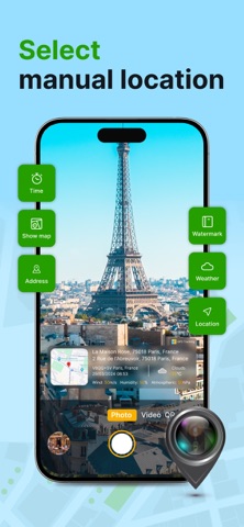
What the numbers say: GPS Geotag Photos & Camera Map runs a light set with one background colour (#9CDCFC) carried across every screenshot — the listing reads as a single poster when the shots sit side by side in search results. The accent colour we picked up, #4C6C7C, is the one to reuse for badges, arrows and highlighted words if you borrow this look. Hit Use this style to open the editor with these exact colours and drop your own screenshot in.
Notice the first screenshot in particular. It's the one users see in search results and on the product page, and it's where most apps spend their best caption and tightest design. Look at the proportion of background to phone, where the text sits, what one thing the image is trying to communicate.
Want to see how other Utilities apps approach the same problem? Browse more Utilities apps in the showcase.
Take what works into your own screenshots
Open LaunchShots and design your App Store & Google Play screenshots — pick a device frame, drop captions, ship in minutes. Free, in your browser.
Open the screenshot editor →Apps with a similar look
Closest background + accent colours among the listings we've analysed — useful when you want to see the same palette handled by a different team.