Screenshots
Icon palette
About this app
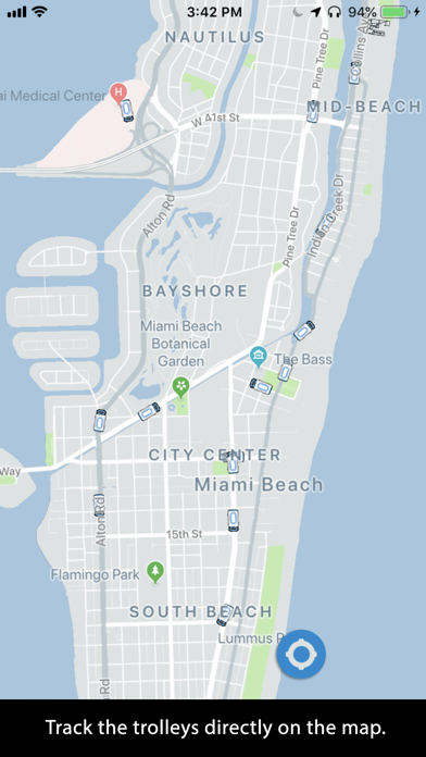
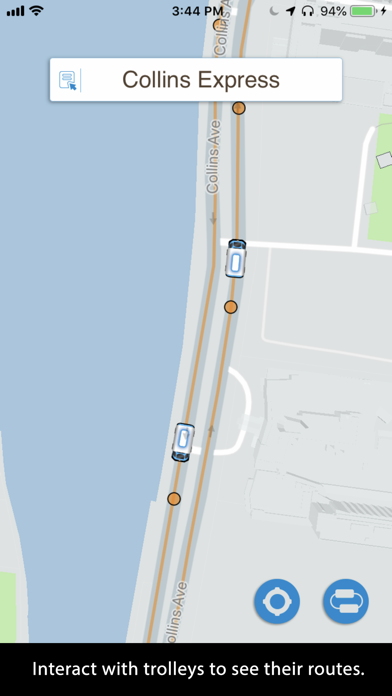
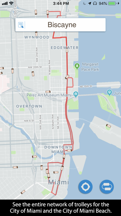
The trolleys are displayed on a map where you can easily and intuitively determine what trolleys are nearest to you. Use this app to familiarize yourself with the vast network of free trolleys available for free to everyone. You will be surprised how many there are! You can track the trolleys and see their routes. Here is how easy it is to use: -Touch a trolley to reveal its route. It will show you the name of the route at the top. -Touch it again to display an animation showing the direction the trolley is moving. -Zoom into the map to reveal the stops. -Touch the service name (box at the top of the screen) to see all of the available trolley routes. -You can hide the trolleys that are not part of the trolley route you selected or you can see the whole network. -Your location is shown with a blue dot. Enjoy!
App details
What you can learn from Miami Trolleys
Every shipping app on the App Store has gone through the same decisions you're working through right now: which screenshot goes first, what caption sits over it, which device frame to show, what color the background should be. The 3 screenshots above are Miami Trolleys's answers to those questions — they're public, they're real, and they made it through Apple's review.
Notice the first screenshot in particular. It's the one users see in search results and on the product page, and it's where most apps spend their best caption and tightest design. Look at the proportion of background to phone, where the text sits, what one thing the image is trying to communicate.
Want to see how other Navigation apps approach the same problem? Browse more Navigation apps in the showcase.
Take what works into your own screenshots
Open LaunchShots and design your App Store & Google Play screenshots — pick a device frame, drop captions, ship in minutes. Free, in your browser.
Open the screenshot editor →