Screenshots


Icon palette
About this app
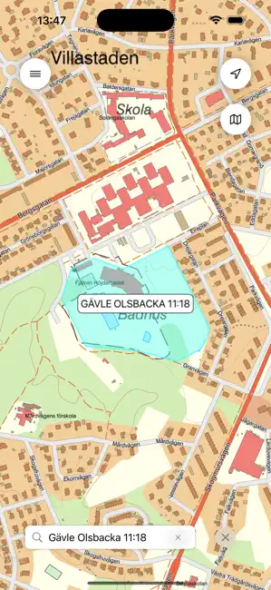
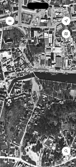
Det här får du i appen: - Karta i form av Lantmäteriets topografiska webbkarta. - Flygbilder i form av Lantmäteriets skalriktiga ortofoton. - Höjdmodell i kombination med kartor. - Översiktliga fastighetsgränser. Observera att gränserna inte syns förrän du har zoomat in en bit i kartan. - Historiska flygbilder från omkring 1960 eller omkring 1975. - Visa din position i kartan. - Markera och namnge dina favoritplatser i kartan. - Dela markerade platser och kartlänkar. - Sök bland ortnamn, adresser och fastighetsbeteckningar. - Mät avstånd och ytor i kartan. Lantmäteriets topografiska webbkarta: topografisk information såsom ortnamn, olika typer av bebyggelse, vägar och järnvägar, adress, fjällinformation, höjdkurvor etc. Lantmäteriets ortofoton: skalriktiga flygbilder i färg. I appen visas den senaste bilden.
App details
What you can learn from Min Karta
Every shipping app on the App Store has gone through the same decisions you're working through right now: which screenshot goes first, what caption sits over it, which device frame to show, what color the background should be. The 6 screenshots above are Min Karta's answers to those questions — they're public, they're real, and they made it through Apple's review.
Notice the first screenshot in particular. It's the one users see in search results and on the product page, and it's where most apps spend their best caption and tightest design. Look at the proportion of background to phone, where the text sits, what one thing the image is trying to communicate.
Want to see how other Navigation apps approach the same problem? Browse more Navigation apps in the showcase.
Take what works into your own screenshots
Open LaunchShots and design your App Store & Google Play screenshots — pick a device frame, drop captions, ship in minutes. Free, in your browser.
Open the screenshot editor →