Screenshots
iPad screenshots

Icon palette
About this app
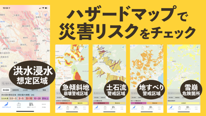
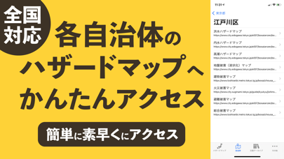
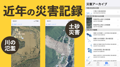
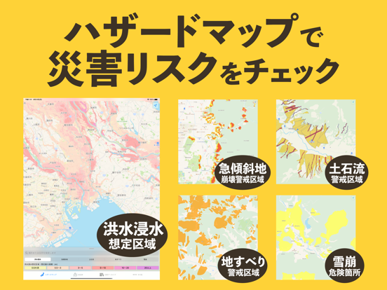
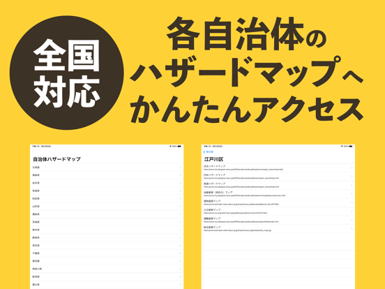
洪水・土砂災害の防災に便利なハザードマップです。 ・洪水浸水想定区域(想定最大規模) ※1 ・急傾斜地の崩壊警戒区域 ・土石流警戒区域 ・地すべり警戒区域 ・雪崩危険箇所 ※2 ・災害アーカイブ(災害当時の正射画像など) 全国自治体発行の詳細なハザードマップへのリンクを搭載。 自治体が公開しているハザードマップに簡単に最短でアクセスできます。 ※1 国管理河川448河川、都道府県管理河川1617河川、その他河川5931河川 ※2 青森県、岩手県、秋田県、山形県、栃木県、新潟県、富山県、石川県、福井県、山梨県、岐阜県、静岡県、滋賀県、兵庫県、島根県、広島県 データの出典 ・ハザードマップポータルサイト https://disaportal.gsi.go.jp/hazardmap/copyright/opendata.html ・国土地理院 https://maps.gsi.go.jp/development/ichiran.html 利用規約 https://hazard-maps-16ad5.firebaseapp.com/termsofuse/index.html
App details
What you can learn from 防災リスマ - 災害リスク・ハザードマップ
Every shipping app on the App Store has gone through the same decisions you're working through right now: which screenshot goes first, what caption sits over it, which device frame to show, what color the background should be. The 6 screenshots above are 防災リスマ - 災害リスク・ハザードマップ's answers to those questions — they're public, they're real, and they made it through Apple's review.
Notice the first screenshot in particular. It's the one users see in search results and on the product page, and it's where most apps spend their best caption and tightest design. Look at the proportion of background to phone, where the text sits, what one thing the image is trying to communicate.
Want to see how other Weather apps approach the same problem? Browse more Weather apps in the showcase.
Take what works into your own screenshots
Open LaunchShots and design your App Store & Google Play screenshots — pick a device frame, drop captions, ship in minutes. Free, in your browser.
Open the screenshot editor →